


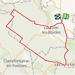
20181111-La Celle les Bordes

patb54
User

Length
19 km

Max alt
181 m

Uphill gradient
215 m
Km-Effort
22 km

Min alt
102 m

Downhill gradient
215 m
Boucle
Yes
Creation date :
2019-01-15 18:30:55.22
Updated on :
2019-01-15 18:30:55.22
4h48
Difficulty : Medium

FREE GPS app for hiking
 SityTrail
IGN / Geographical institutes
SityTrail Plus
The world is yours!
About
Trail Walking of 19 km to be discovered at Ile-de-France, Yvelines, La Celle-les-Bordes. This trail is proposed by patb54.
Positioning
Country:
France
Region :
Ile-de-France
Department/Province :
Yvelines
Municipality :
La Celle-les-Bordes
Location:
Unknown
Start:(Dec)
Start:(UTM)
423856 ; 5388235 (31U) N.
Comments